
Unlike some states in the U.S., California is so large it has many distinct regions and geographical features. Spread through its nearly 164,000 square miles, California has 58 counties and 482 cities and towns, and with more than 39 million people, it’s the most populated state in the country.
Unofficially divided into three regions – Northern, Central, and Southern California – California is one of the few places in the world that has beaches and snow, deserts and high mountain peaks, and some of the richest agricultural land in the world.
Fun facts! California also has the highest and lowest points in the contiguous US: Mt. Whitney (14, 494 feet) and Badwater Basin in Death Valley National Park (282 feet below sea level), as well as some of the country’s tallest and oldest trees.
Whatever environment calls to you, you’ll find it here in California.
Explore the regions and highlights of each, from north to south.
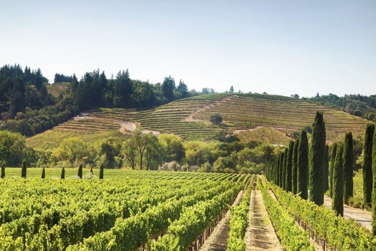
Northern California has everything from the lush Redwoods State Park to immense Shasta Lake and the iconic city of San Francisco. Find your perfect place to study in Northern California.
Much of the northern-most region in California is rural, with nature preserves, redwood and other forests, and lots of trails. The area’s cities have fine dining, music festivals, and wineries to enjoy. The North Coast’s climate ranges from mild winters and summers toward the coast and hot summers and snowy winters inland.
The Shasta region, found in northern California, is home to the city of Redding, as well outdoor attractions like Shasta Lake, Lassen Peak, Turtle Bay Exploration Park, and Sundial Bridge. Established in 1850, Shasta County was one of the original counties of California and its rich culture features arts, museums, music and year-round outdoor recreation.
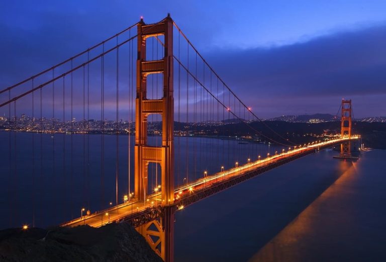
Located in northern California, the San Francisco Bay is home to the cities of Oakland, San Francisco and San Jose, as well as Silicon Valley, the world-famous region that includes tech companies like Google, Yahoo, Apple, and Tesla. Climates range from coastal with cool temperatures and fog, to hot summers and cold winters inland. The San Francisco Bay Area is also known for its beautiful beaches, top-notch restaurants, lively theater, and the world-renowned wine regions of Napa and Sonoma.
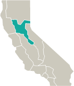
Gold Country is a region in the central and northeastern part of California famous for its mineral deposits and gold mines that attracted floods of immigrants during the 1849 California Gold Rush. Gold Country is home to Sacramento, the state’s capital, as well as many festivals, landmarks, and museums that highlight the area’s rich history. You can still pan for gold in local rivers, which are also known for their fishing, kayaking, and rafting opportunities. The climate is perfect for growing grapes, and wine is one of its primary industries with more than 100 wineries in the region.
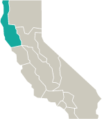
Central California is a land of variety and abundance, from the highest mountain in the state (Mt. Whitney) to the Central Valley’s agricultural abundance, which produces more than a third of the United States’ vegetables and two-thirds of its fruits and nuts. It’s also home to well-known Central Coast cities like Santa Barbara and Monterey. Find your perfect place to study in Central California.
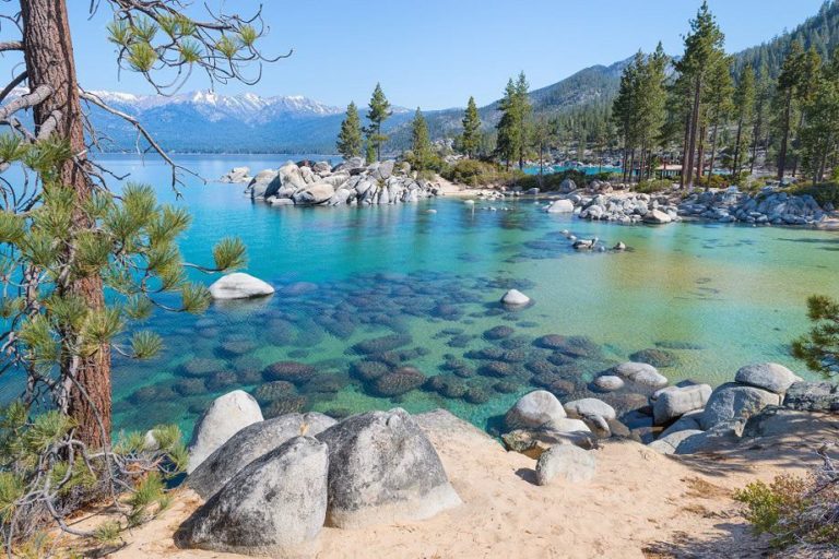
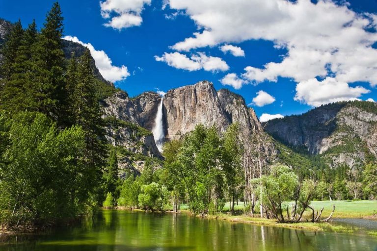
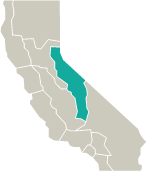
Home to Kings Canyon, Lake Tahoe, Mammoth Mountain, Sequoia and Yosemite National Parks, and Mt. Whitney (14,404 ft.), the High Sierra region is bursting with breathtaking scenery. You’ll find fascinating festivals, world-renowned ski resorts, and a culture rich in arts and music. The High Sierra is also home to Sequoia trees, the largest and oldest trees on Earth.
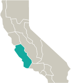
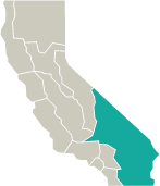
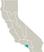
Home to Monterey Bay, Santa Barbara and San Luis Obispo, plus the famous Big Sur, the Central Coast is the perfect mixture of rural and urban atmospheres. Whether you prefer the energy of the city or the tranquility of the rural areas, you’ll find the both in the Central Coast. From spotting celebrities, to visiting a castle, to exploring a winery, and discovering its beautiful beaches, large lakes, rivers, parks, and wildlife refuges, the Central Coast has it all, plus a temperate climate!
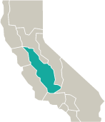
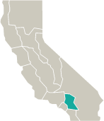
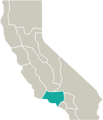
As its name suggests, Central Valley is a large, flat valley located in central California. The area is known for its agriculture, and here you will find an abundance of farmers markets, roadside produce stands, and festivals that celebrate the local cheese, crops, and wine. Central Valley is home to the cities of Bakersfield, Fresno and Stockton, as well as concert venues, gardens, museums, and racetracks.
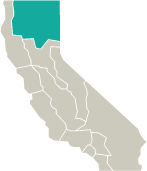
Southern California is a land of contrasts: home to Hollywood and movie stars, as well as the pristine desert landscapes of Joshua Tree National Park and Mojave National Preserve, and the birthplace of Disneyland. With bustling inland cities to the coastline of San Diego, SoCal is quintessential California. Find your perfect place to study in Southern California.
In addition to its natural beauty and warm weather, southern California’s deserts feature endless entertainment opportunities. Art galleries, horseback riding, hot air ballooning, spas – the deserts have it all! This region is home to the Mojave National Preserve, Joshua Tree National Park, and Death Valley, which contains the lowest, driest, and hottest points in the United States.
Located in southern California, the Inland Empire is home to Ontario, Palm Springs, and Riverside County, and is one of the fastest-growing regions in the state. Despite its bustling atmosphere, Inland Empire stays true to its agricultural roots and contains many farms and wineries. The beautiful Big Bear Lake, San Jacinto Mountains, and Bernardino National Forest can also be found in this area.
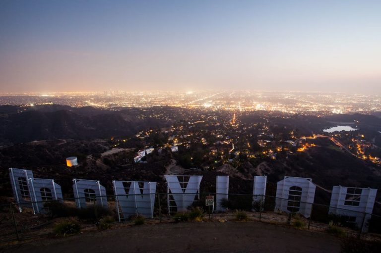
The most populous city in California, Los Angeles is famous for its art, culture, and many famous attractions. With an array of amusement parks, architectural landmarks, art museums, beaches, cinemas, golf courses, live music and comedy, museums, nightlife, parks, restaurants and shopping districts, you will never have a dull moment in Los Angeles. If you love movie stars and pop culture, this city is for you!
Located in southern California, Orange County is home to the cities of Anaheim and Fullerton, and it’s the sixth most populous county in the United States. Orange County is mostly urban and is known for its classic beach towns, film festivals, fine restaurants, museums, ballet and opera, performance venues, shopping centers and theme parks. Yes, Disneyland is here!
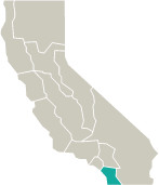
Located along the Pacific Coast, San Diego is the second largest city in California and the eighth largest city in the United States. San Diego ranks high in the tally of most educated cities in the U.S., and it’s known for its mild climate. The city boasts 70 miles of coastline, a world-renowned zoo, famous golf courses, great food, museums, nightlife, shopping, theme parks, and an active theater scene.